OH NO! Not another Alphabet!
Yes it is. I wrote this during one of the lockdowns – a Devon Alphabet. Places I know in this fantastic county!
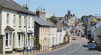
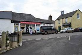
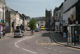
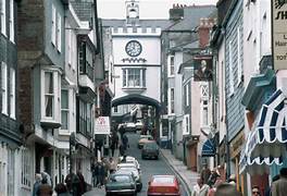
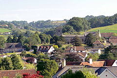
A is for Ashburton
One of the gateways to Dartmoor. A typical Devon town with its history based on farming as well as having been a Stannary town dealing with tin mined on the moors.
Was the terminus of the branch line from Totnes and although the station still exists, the line was closed in the 1960’s and cut when the A38 was widened. You can still travel on the preserved South Devon Railway as far as Buckfastleigh.
The town has a wide variety of businesses and pubs. The Exeter Inn is by far the oldest. The old Golden Lion Inn was the headquarters of the ‘Monster Raving Loony Party’.
The town is likely to increase in its fame as it is the setting for a series of detective novels by local author Stephanie Austin – starting with ‘Dead in Devon’
B is for Barnstaple
In the far north of the county and another railway terminus. The Tarka Line from Exeter now terminates here though previous the line went on to Bideford and also a line came in from Taunton.
The rail trip is very pleasant and I have done it a number of times. Most recently this has been to visit the Lynton and Barnstaple Railway – or the part that has been restored at Woody Bay. There are ambitions to complete the whole railway of 19 miles though at present they have a mile and are working on the next section of around 9 miles. The target for this extension is 2026.
Barnstaple itself is thriving market town at the lowest crossing point of the river Taw. It has an historic Pannier Market and Butchers Row – 10 stone built shops.
I have also worked in the town and neighbouring Bideford and Bantham on various projects.

C is for Chagford (and Castle Drogo)
A place I have visited a few times including a meal in the ‘Three Crowns’ and a beer in other hostelries. A proper market town again in close proximity to Dartmoor which supplied its trade in wool and tin. One of its many interesting buildings is the thatched Lloyds Bank – which seems to have survived total closure and operates 3 days a week!
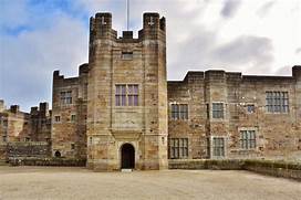
Nearby and definitely worth visiting is Castle Drogo. Now owned by the National Trust it was designed by Edwin Lutyens for the founder of Home and Colonial Stores – Julius Drewe. Built of granite over 19 years in the early 20th Century it was the last castle to be built in England. The views from the grounds are outstanding.
Another place close by is Easton Court where Evelyn Waugh wrote ‘Brideshead Revisited’.
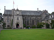
D is for Dartington Hall
Dartington Hall was developed by the Elmhirsts in the early 20th century. They were a wealthy couple and they restored the buildings and developed all forms of education on the site. It is now run by a Trust.
The main building of importance is the Great Hall but there is also the Barn Theatre and High Cross House. Much of the Estate is Grade I listed and the impressive gardens are Grade II. There are numerous excellent walks especially down by the Dart where the view across the river is of the South Devon Railway.
I have worked occasionally at Dartington in some business capacity but my main experience was as a member of the Playgoers Society which put on an annual Shakespeare in the Private Gardens and plays in the Barn Theatre.
In the garden I have been involved in A Midsummer Nights Dream (twice), Julius Caesar, Comedy of Errors, Henry V, and Macbeth. A great spectacle -often affected by the weather. I have also stage managed The Dresser in the theatre.

E is for Exeter Canal
The Exeter (Ship) Canal runs for 5 miles from the basin where it joins the River Exe to its ending at Turf Lock. It was initially built in the 16thcentury and was used for transport of goods to and from the city until about 1972.
At the canal basin, there are shops and pubs including the nearby Prospect Inn and also a hand pulled ‘Butts Ferry’ which has also been around for over 300 years.
Like all canals it is a pleasant walk and after passing industrial estates comes in to open country, passing under the Ring road and also the M5. The ring road bridge is a bascule bridge and does not open very often. A pleasure boat runs from there to the end and out into the Exe Estuary.
The walk takes you past two excellent pubs. The Double Locks has long been a favourite and usually has a wide range of real ales.
The Turf Hotel at the end used to have restricted opening but nowadays is open regularly. The downside is that you can only walk, cycle or boat your way there – no driving access!
You can continue to walk down the estuary to Cockwood but the last miles are nearly all on road.
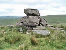
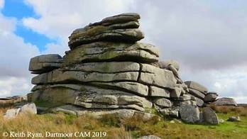
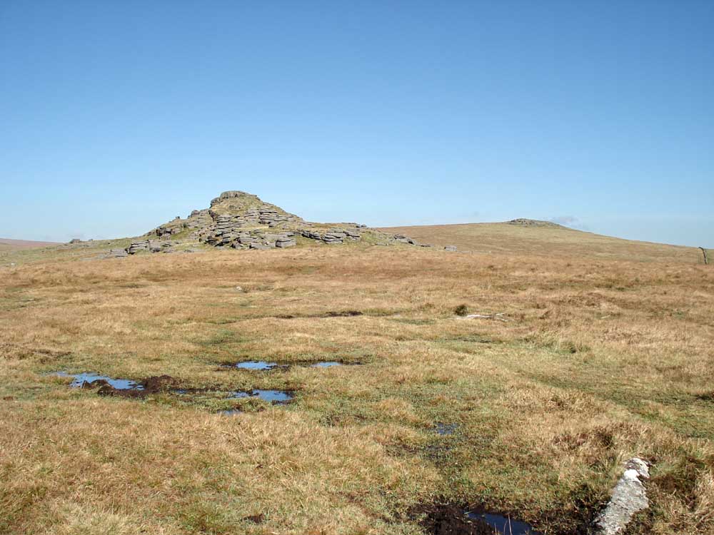
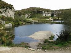
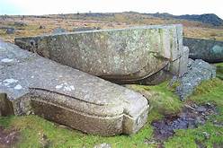
F is for Fox Tor and Fur Tor
Two well known Dartmoor Tors – one on the south moor and the other on the north.
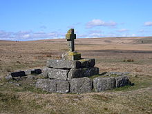
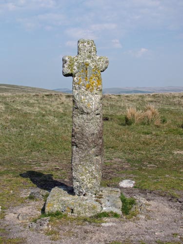
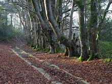
Fox Tor is not a large tor. It is south of Princetown and is accessible by walking from the road to Whiteworks. A little to the north is Childe’s Tomb – marked with a cross – which is supposedly the resting place of a hunter who died there while sheltering from a blizzard. He died despite disembowelling his horse and sheltering in the hide. There is believed to be a kistvaen underneath. The present cross is a replacement as the original stone structure was destroyed and used to build the short-lived Fox Tor Farm. (Pictures 1& 2)
A little to the northeast is Foxtor Mires – rumoured to be the inspiration for the Grimpen Mire in ‘Hound of the Baskervilles’.
By contrast, Fur Tor (or Vur Tor as it has been known) is a very large tor on the North Moor. Often known as ‘ The Queen of Tors’ . From the west the route is from Willsworthy along the Amicombe Brook. For a long time it was one of only two Dartmoor Letterboxes which were marked on OS Maps
The remaining box shown on the map is to the NNE of Fur Tor at Cranmere Pool. This is the site of the very first letterbox sited in 1854 by James Perrott – a Dartmoor Guide. The present ‘box’ is a permanent structure.

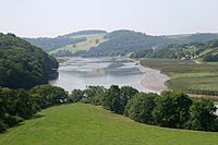
G is for Galmpton and Greenway
Closer to home now. Galmpton is the next village to Kingswear along the Dart. Home to a good primary school and to the Manor Inn where I played in their quiz team many years ago. Galmpton Creek is the site of a boat yard where the Western Lady fleet of boats was moored and maintained (and may still be!). There is also a marina and boat repair yard.
Greenway is on the Dart opposite Dittisham where a ferry service runs across to the landing spot near the Ferry Boat Inn. In normal times they run most of the time and also have a service to and from Dartmouth and Greenway House.
Greenway House is a Georgian property now in the hands of the National Trust but for many years it was the holiday home of Agatha Christie. She purchased it before WWII and during the conflict it was requisitioned for use by the US Coastguard. One of the members painted a frieze on the Library wall.
Greenway is the setting for one of her books – ‘Dead Man’s Folly’.

H is for Honiton
We first came to Devon on holiday when I was about 6 I suppose. One of the nightmares of the journey was the traffic jam through Honiton which was relieved in 1966 by opening the by-pass. The original road is part of the Roman Fosse Way from Exeter to Lincoln. The by-pass is now part of the improved – but not complete – A30.
Honiton over the years has been famous for its lace – much of which is on display in its Allhallows museum.
My last visit was a few years ago when Angela and I went by train. The station is one of the passing places on the partly singled South West Railway line to London via Salisbury. We had an interesting walk around the town and a pleasant afternoon tea in a cafe behind a pub. It was unfortunately the wrong time of day to be drinking but there appear to be a number of good hostelries! On our return journey the display on the platform advised us that the train was full and standing only. Turned out to be nonsense!
I is for Ipplepen and surroundings
I have not been to Ipplepen for some time. We were regular visitors to the Plough Inn for darts matches but that is now closed. The remaining pub is the Wellington. Not too far away on the main road is the Two Mile Oak which has always sold good selections of real ale.
Ipplepen is sort of in the middle of the triangle of Torbay, Newton Abbot and Totnes. The village seems to stretch out to Fermoys Garden Centre (Home of the annual Abbfest Beer Festival), and Dainton Golf Club. There have been a number of archeological digs in the area with discoveries of Roman and other remains. In 2015 a Roman Cemetary was found containing 15 skeletons.
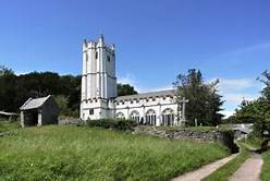
A few miles away is the small hamlet of Torbryan. We used to be regular visitors to the Church House Inn to eat. It is – not surprsingly – opposite the rather fine church. This was in the news a few years ago when thieves stole 2 mediaeval panels but fortunately they were recovered a few years later.
Apparently – though I have not been – there is a set of caves nearby where animals remains such as mammoth, hyena and cave bear have been found.
J is for Jay’s Grave
Situated at a crossroads not far from Hound Tor on Dartmoor is what appears to be a grave with stones and usually fresh flowers. Known as (Kitty) Jay’s Grave it is associated with a number of legends.
It is supposedly the grave of a young girl – a maid from a nearby farm – who committed suicide in the 18th Century when finding herself pregnant by a farmhand or a member of the family. No cemetery would allow a suicide to be buried in consecrated ground and the custom was to bury the person at a crossroads.
The grave was apparently opened by the landowner in 1851 when a skeleton of a woman was found. It was then reburied in the same spot – now no longer a crossroads. There are always fresh flowers on the grave and it is not supposedly known who places them there. Needless to say there are also tales of ghosts seen in the area and some Dartmoor folk would not pass the grave at night.
The grave has been an inspiration for books and music. Beatrice Chase wrote ‘Heart of the Moor’ in 1914 and John Galsworthy ‘The Apple Tree’. Some believe that Beatrice was responsible for the flowers during her lifetime. The rock band Wishbone Ash wrote ‘Lady Jay’ and local folk singer Seth Lakeman produced a ‘Kitty Jay’ album.
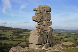
Not far away is the large stone outcrop known as Bowerman’s Nose. It is a 21ft high granite outcrop -the remains of an eroded tor.
Again it has a legend attached. John Bowerman was a huntsman who disturbed a coven of witches. As a punshment he was turned into stone – as were his dogs which are now the top of Hound Tor. If you believe that……
Again not far away is the appropriately named mobile food van – The Hound of the Basket Meals!
K is for Kingswear
I cannot do an alphabet without referring to the village where I have lived – in different parts – for more than 50 years.
I already mentioned the station and centre in my Railway Alphabet. I have for the past 30+ years lived at Kingston which is a hamlet of 6 properties which at one stage was a farm and its associated cottages. One of our neighbours wrote a history of the farm and the cottages on behalf of Kingswear Historians. The farmhouse was built around 1750 and our cottage – the last to be built with its neighbour – was completed in 1905.
We are surrounded by farmland now mostly part of Boohay Farm, Fountain Violet and Woodhuish. The National Trust owns Coleton Farmhouse as part of the Colten Fishacre Estate.
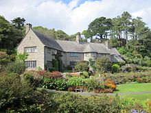
Coleton Fishacre was built for the D’oyly Carte family in the early 1920’s designed by a pupil of Edwin Lutyens. (Picture 1) When open both the house and the gardens are worth a visit. Unfortunately the road which passes our house is narrow and does not work well with hordes of visitors meeting farm traffic. Amazing how few people know how to reverse!
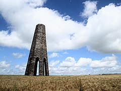
Between Coleton Fishacre and Kingswear – near the Coast Path – is the Daymark. This 180 ft high octagonal tower was built in 1864 as a beacon for navigation. (Picture 2). I believe there is also the remains of a barrow or similar close by.
L is for Littaford Tor. Longaford Tor and the Lych Way.
These two tors are close together north of the B3212 from Moretonhampstead to Princetown. It was one of our earliest expeditions doing Dartmoor Letterboxing though I recall we went the wrong way and got a bit ‘bogged down’!
Between the two tors – Longaford being the larger – runs the Lych Way. This is an acient track used to carry the dead from the Bellever area across the moor to the town of Lydford. This was the parish that covered that area of the moor but later Widecombe Church was built and the dead had a much shorter journey. It is also known as the ‘Corpse Way’ and ‘Way of the Dead’. It was still used until the 1800’s to travel to the Stannary Courts at Lydford. As with Jay’s Grave it is the subject of stories and songs.
Also nearby are the Powder Mills – once used for the manufacture of gunpowder for use in the local quarries.
Also between the tors is the ancient Wistman’s Wood. Probably part of the old Forest of Dartmoor it consists mainly of oaks, growing in amongst boulders. Because of the soil and the local conditions they are stunted and twisted and can be an eerie place!
One other story can be heard about the locality. On the B3212 there have been many reports in the 20th Century of the steering wheel of a car or handlebars of a motorcycle being grabbed by 2 ‘hairy hands’ (or sometimes invisible hands). The vehicle has then been forced off the road unless the driver is able to overcome the power of the hands!

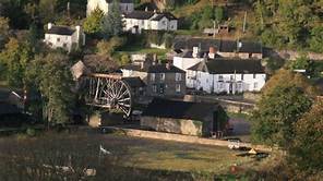
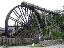
M is for Morwellham Quay
Morwellham Quay is now a tourist attraction a few miles from Tavistock.
It is on the bank of the River Tamar and was built in the 18th and 19th century to serve mining in the locality. The site goes back further in time when monks used it to ferry goods to Plymouth. The mine was operated by Devon Great Consols and mainly produced copper, tin, lead and silver.
Many of the buildings have been restored – including a pub which wasn’t there when I visited many years ago. The assayers’ offices have been carefully preserved and Victorian cottages, farm and schoolrooms presented. The ore-crushing plants driven by a 32-foot overhead waterwheelcan be seen. A battery electric-powered tramway, constructed as part of the tourist attraction in the 1970s, takes visitors for tours on a single level of the George and Charlotte copper mine.
A restored dock includes a restored sailing ship – The Garlandstone.
The Quay is an important part of the Tamar Valley Area of Outstanding Natural Beauty. Another attraction close by is Cotehele House – run by the National Trust.
The Tamar Valley railway line runs from Plymouth to Gunnislake and is a very scenic route.
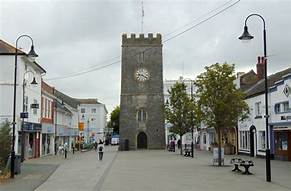
N is for Newton Abbot
Newton Abbot has to be in my Devon Alphabet as I worked there for many years – mostly in Devon Square.
The market town dates back 750 years – there were two being Newton Abbot and Newton Bushel which merged in the 17th Century. There is still a weekly livestock auction and a turkey auction in December of each year.
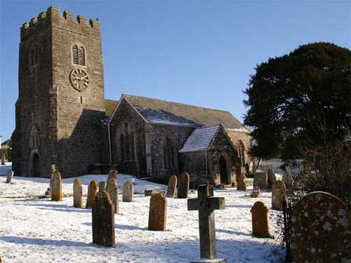
St Leonards Tower as seen in the first picture was part of a larger structure being a medieval chapel dating back to 1220. King William III stayed overnight in Newton Abbot after his landing in Brixham in 1688.
Wool has been a main industry in Newton Abbot and until recently was was large maltings producing malt for the brewing industry. Although that has ceased to operate Teignworthy Brewery still brews on the premises.
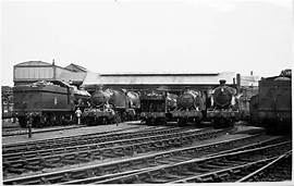
Otherwise for many years the largest employer was the railway depot. Situated close to Newton Abbot Station. The yard was developed after the Great Western Railway acquired them in 1976. Up to the middle of the 20th century it employed up to 1000 and changed from a steam depot to diesel. Now little remains and the yard is now covered by the Brunel Industrial Estate which does have some manufacturing industry.
Newton Abbot is also home to England’s most westerly racecourse.
O is for Okehampton
Okehampton is the major town of North Dartmoor. I’ve been there many times either stopping or passing through. A number of meetings/conferences were held in the White Hart Hotel which is now a Wetherspoons and I used to help audit the accounts of a food manufacturing business in the industrial estate. Nowadays it is by-passed to the south and traffic is much lighter.
To the south the is the Castle and also the best access to the moor via Okehampton camp. The castle dates back to Norman times and as been the subject of a painting by J M W Turner. The camp was established for military training in the 19th century and today is the base for training on the firing ranges in many parts of Dartmoor. Red flags are flown to warn walkers to avoid the area when firing is taking place.
The camp is also the starting point for the annual Ten Tors Expedition for young people of all ages and abilities and it is supervised by the Army. It began in 1960.
Okehampton still has a railway station but it is not at this time part of the national network – but will be soon – see below. Until 2011 trains ran from Meldon Quarry – west of the town – carrying ballast stone. It has been operated by Dartmoor Railway but this company went into administration in 2020.
We have travelled on the railway from Exeter during the period when under the auspices of Devon County Council Sunday only services ran from Exeter St Davids. In 2021 the railway will re-open on a permanent basis with service run by Great Western Railway.
P is for Princetown
Princetown is the main settlement actually on the moor and is overshadowed by Dartmoor Prison.
Started by Sir Thomas Tyrwhitt at the end of the 18th century the settlement was named after the Prince of Wales. One the two pubs is named Prince of Wales and the other the Plume of Feathers reflecting the prince’s symbol. There is also a brewery!
The prison was built in 1806 for prisoners from the Napoleonic Wars, closed in 1851 then re-opened in 1851. Its days are now numbered. At one time it held up to 9000 prisoners but now only 640.
In 1823 a railway was formed for transport of granite but the railway from Yelverton which was part of the Great Western Railway did not open until 1883. It closed in 1956. The trackbed which winds it way almost in a circle around King Tor is now a walking route which is of course very level. It also passes Leeden and Ingra Tors. North Hessary Tor with its television mast is to the north of the village with the equivalent South Hessary Tor to the south. The Devonport Leat which carries Dartmoor water to Burrator Reservoir and onto Plymouth passes close to the village.
There is a National Park Centre in the middle of the village. The Plume of Feathers marks about the halfway point on the Abbots Way between Buckfast Abbey and Tavistock.
Q is for Quarries
Dartmoor has a number of quarries -mostly for granite.
The best known is probably Haytor as it on the tourist route. The quarries are in the shadow of the tor and have been used since the 18th century. In 1820 a granite tramway – the remains of which can be seen to day – was built to carry the granite down to Stover Canal. The stone was in demand for London Buildings such as London Bridge (the one which is now in the USA) but by the mid 19th century Cornish granite was cheaper.
Some of the quarries have filled up with water – Haytor Pools. The area is now a Site of Special Scientific Interest..
Merrivale Quarry (also known as Tor quarry) operated from 1876 and was the last of the Dartmoor quarries to close in 1997. Again used for London buildings including the facade of New Scotland Yard and I think most lay claim to doing something for London Bridge!! The granite from Merrivale was also used to pave Trafalgar Square and also the Falkland Memorial. Because its closure is so recent there are still rusting remains of machinery around the quarry site.
Near Princetown and the railway are a group of quarries. King Tor, Swell Tor and Foggintor Quarries. All that remains now is the spoil heaps and also some granite blocks (corbels) which had been cut and carved – possibly to repair London Bridge when it went to the USA. Foggintor also produced the granite for Nelson’s Column.
By the 1840’s 300 people worked at Foggintor and around 100 lived in quarrymen’s cottages on site. Little remains now and the area is now used for filming, adventuring, training camps etc.

R is for Royal Devon
Many places in Devon have royal connections of one kind ot another. Here are three.
Britannia Royal Naval College (BRNC) Dartmouth was established in 1863 when the hulk of HMS Britannia was moored in the River Dart, followed a year later by HMS Hindostan. These supplied the accommodation for training officers until 1905 when the present buildings were opened on the hill overlooking the river.
Kings George V and VI both attended the college as did The Duke of Edinburgh (where he first me the Queen) Prince Charles and the Duke of York. Prince William was also there briefly during his military training.
The college is now the only place in England training naval officers. It is properly known as HMS Britannia.
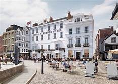
With not such direct Royal connections, the Royal Clarence Hotel on Cathedral Green at Exeter was the premier hotel in the city. Originally built in the mid 18th century it was updated in 1827 and gets its name from a visit by Adelaide Duchess of Clarence in the same year.
It was almost complete destroyed, with the adjoining Well House Tavern, in 2015 by a huge fire. The restoration is beginning with the restoration of the original grand façade with a modern hotel behind.
The Royal family makes regular formal visits to Devon. Annually a member of the family attends passing out parades at BRNC. For a while the South Devon Railway north of Totnes was a stabling point for the Royal Train.
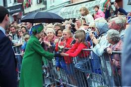
In 1988 the landing of William of Orange at Brixham 300 years previously was commemorated by a visit from the Queen, the Duke and the Prince of the Netherlands. A re-enactment took place (in which I had a minor role) and a new commemorative plaque unveiled.

S is for Slapton
Slapton village is almost exactly halfway between Dartmouth and Kingsbridge. The village itself is a little way inland from the beach and boast two good pubs – Tower Inn and Queens Arms. The Tower named after the adjoining structure originally part of a chantry.
The two main interests around the village are Slapton Ley with its wildlife and Slapton Beach with its historical connections.
The Ley is a freshwater lake created by the shingle ridge which divides from the sea. The A379 which crosses the ridge has been damaged many times by storms. The Ley is a Site of Special Scientific Interest and a National Nature Reserve. Amongst its rare wildlife are birds (Cetti’s Warbler , cirl bunting), plants (strapwort) and mammals (otter, dormice). There have also been recorded 14 different species of bat.
The beach was used – along with many inland areas – for training for the D-Day Landings of 1944. It was chosen for its similarity to some of the Normandy Beaches particularly Utah Beach. At the end of 1943 orders were issued to evacuate 8 villages and all outlying farms – from Strete to Chillington and inland to Blackawton. Churches were emptied of valuables as there was no guarantee of no damage.
The main rehearsal was Exercise Tiger during April and May 1944. The main incident was an attack by E-boats on a convoy of landing craft of the US1st Engineer Special Brigade and over 700 were killed. At the time – for obvious security reasons – the scale of the disaster was never publicised.
Ken Small – a local resident – took on himself proving a memorial. He obtained permission to recover an M4 Sherman Tank from the seabed and this is now displayed at Torcross on the Western end of the beach.


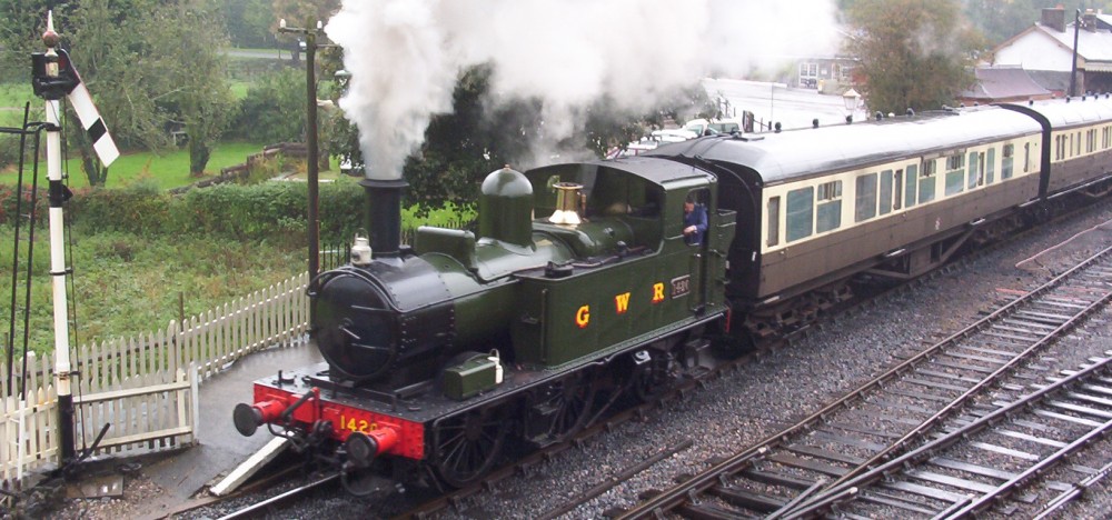
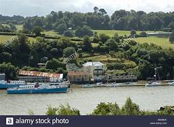
T is for Totnes
I am a very regular visitor to Totnes – mostly as a volunteer on the station of the south Devon Railway.
The town itself goes back to the 10th century and the castle was built during the reign of William I. Legend has it the Brutus – the founder of Britain – stepped ashore at Totnes and this is recorded on a stone in the High Street. A charter was granted by King John in 1206.
The Dart is tidal as far as a weir to the north of the town and for many years the Baltic Wharf received ships loaded with timber from Scandinavia until 1995. Today Totnes is regarded as having an ‘alternative’ culture being a ‘Transition Town’ and at one time having the Totnes Pound as its own currency which could only be used in businesses in the town.
The Great Western Railway came to Totnes with the opening of the station in 1847. It still has regular express services to London, the north and West to Penzance. There was a short branch line which led down to Totnes Quay, crossing the road near the bridge over the Dart.
The other branch was to Buckfastleigh and Ashburton via Staverton which opened as a broad gauge line in 1872. It was used for passenger traffic and the conveyance of goods including wool. BR closed the branch to passengers in 1958 (before Beeching!) and to goods in 1962. It was re-opened as a heritage line – by Dr Beeching – in 1969 but the section from Buckfastleigh to Ashburton was lost during the widening of the A38.
The line still runs being owned and operated by the South Devon Railway Trust.


U is for Uffculme, Ugborough, Umberleigh and Uplyme.
Not many places in Devon with a U which I know well so I have selected four in very different parts of the county..
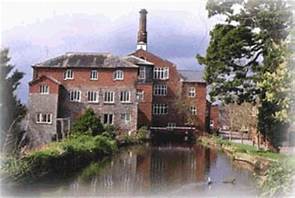
Uffculme is in mid Devon and is on the River Culm and close to the main town of Cullompton. Its main claim to fame now is the restored Coldharbour Mill.
The mill is a working wool museum based on the business that was operated there from the late 18th century. The mill was in constant operation until 1978. It is unusual that it is powered by both a water wheel and a steam engine. The water power was used for the night shift – the steam engine driven by a Lancashire boiler which still works today. One of the products still made is a Devon Tartan.
Uffculme was also the site of a fireworks factory which was almost destroyed in an explosion in 1988.
Ugborough is in the South Hams. I have visited it on occasions and passed by many times on the road towards Kingsbridge from Totnes. It is also close to the A38 Expressway and the new Ivybridge railway station. There are two pubs – surprisingly for an inland village the are the Ship and the Anchor.
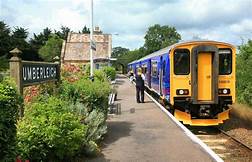
Umberleigh I only really know from passing through on Tarka Line trains from Exeter to Barnstaple.
It is in north Devon just two stops away from Barnstaple and is on the banks of the River Taw. Pre the Norman conquest it was held as a barony by King Athelstan but William II granted it to the Baron of Gloucester. Later the Soliegny, Champernowne (later of Dartington Hall) and Willington families were holders.
Nearby is the Grade I listed Umberleigh House and the local pub is the Rising Sun.
Uplyme is in East Devon very close to the seaside resort of Lyme Regis which is across the border in Dorset. Lyme Regis with its fossils is probably better known. There were three pubs but only the Talbot remains.
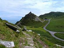
V is for Valley of the Rocks, Lynton and Lynmouth
The Valley of the Rocks is a dry valley west of Lynton which is known for its feral goats. I did walk there many years ago.
It is also full of literary connections. In particular Samuel Taylor Coleridge and William Wordsworth are known to have walked there together. They decided to write a prose tale based on the area but it was never finished. Robert Southey was also a visitor and R D Blackmore based part of Lorna Doone in the Valley.
Lynton and Lynmouth are twin villages joined by the Lynton and Lynmouth Cliff Railway. This was built by the publisher George Newnes in the late 19th Century partly because of the influx of visitors to Lynmouth arriving by sea and needing to get up to Lynton. The difference in height is over 500m. The railway is operated by water drawn from the River Lyn and emptied into tanks on each car so that they counterbalance. The buildings have Grade II listed status. There is an excellent café at the top.
Lynmouth was the scene of a natural disaster in 1952 when the West Lyn River, blocked by fallen trees and debris was hit by a large rainstorm and burst its banks. 100 buildings were destroyed and 34 people died. The village was rebuilt.
I have already referred to the Lynton and Barnstaple Railway which had a terminus on the outskirts of Lynton.

W is for Woodbury and its Common
I have not covered much in East Devon and have only been to Woodbury a couple of times. The Avocet line from Exeter to Exmouth calls at Exton by request and this is the nearest station.
One visit was for a wedding for which we were late due to traffic around Exeter so instead of going into the church late we had a quick beer in the White Hart next to the church. All good village pubs are close to the church!
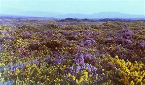
Woodbury Common is an area of heathland close to the village and is in the East Devon Area of Outstanding Natural Beauty and is a Site of Special Scientific Interest. It contains an Iron Age Fort, and is home to many uncommon species such as the nightjar which migrates from Africa annually.
It was the site of a battle in 1549 between rebels from Devon and Cornwall and the Kings Troops. This was during the Prayer Book rebellion protesting against the reformation prayer book. Now is is a training ground for Royal Marines from nearby Lympstone Barracks.
Woodbury Manor Golf Club was owned by retired racing driver Nigel Mansell but he sold in 2007 for £18 million.
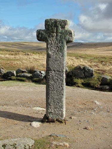
X is for Crosses!
There are crosses of all types and sizes dotted around the moor. Some are ancient and mark paths, others newer. I am indebted to an excellent website – http://www.dartmoor-crosses.org.uk for information and pictures though I have visited the three I have chosen. The site does include some crosses in churchyards and at the end of January 2021 listed 199! I’m sure they’ll find another!
One of the main tracks which I have completed twice is the Abbots Way between Buckfast Abbey and Tavistock -about 25 miles.
Horns Cross
According to the web-site, Horns Cross is on not quite the route I followed. I it is amore northerly and slightly different Monks Path. It crosses the path from south Brent to Hexworthy. The cross is not far from Venford Reservoir on Holne Moor. It is reckoned to be c 14thCentury, over 6ft tall, and has at some stage been repaired with an iron rod.
Petre’s Cross
Located close to the summit of Western Whittaburrow, Petre’s is one of four crosses, erected in the 16th Century, by Sir William Petre to mark the boundary of the Manor of Brent. Of the other three one no longer exists. The cross was damaged by miners from Red Lake using stone to build a shelter. The site is not far from Crossways where the Abbot’s Way crosses the Two Moors Way. It is just under 4ft tall.
Siward’s Cross or Nun’s Cross.
One of the largest crosses on the moor, Siward’s Cross is nearly 7ft tall. It stands near the crossing of the Abbot’s Way and the Monks’ Path and bears the inscription BOC LOND which may refer to Buckland. Siward whose name appears on the cross was an Earl with lands locally though he does appear as Earl of Northumberland in Shakespeare’s Macbeth. There does not appear to be any connection with Nuns or a nunnery to give its alternative name. The nearby derelict farm is Nuns Cross Farm. It is also close to the Devonport Leat which carries water from the North moor to Burrator Reservoir.
Y is for the ‘Tor where the Sun shines backwards’!!
This is part of a Dartmoor Letterbox clue for Yar Tor – between Poundsgate and Dartmeet.
We were introduced to Letterboxing after son James went on a short residential break at Broadleas near Haytor when he was at Kingswear Primary School. That was his first experience of the hobby. The family did a lot of ‘boxing’ over the years sometimes a 10-12 mile walk in a day and have acquired over 2000 stamps.
For his 10th birthday we put out his own letterbox without his knowledge. The clue is ‘Ray’ backwards giving you Yar and then more details of the actual site in the rest of the clue. He was absolutely delighted when he found it!.
Yar Tor itself overlooks the East Dart and has tremendous views incluidng Corndon Tor with its stone row to the East and Sharp Tor to the south.
A few miles to the north East is Yarner Wood Nature Reserve purcheased in 1952 as one of Englands first Natiional nature Reserves. It is an oak wood in the Bovey Valley with plenty of walks, much wildlife and an old mine. Look out for pied flycatchers, woodpeckers and wood warblers in the woods, Dartford warblers, ponies and fritillary butterflies around the moorland, and dippers along the River Bovey.
Z is for Zeal
A few ‘Zeals’ around Devon.
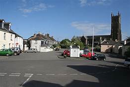
Zeal Monachorum is a village almost in the centre of the county, between North Tawton and Copplestone. The word Zeal is believed to come from the word for ‘cell’ and Monachorum is ‘of the monks’. The village has a population of around 400 and is situated on the River Yeo.
The village appears in the Domesday Book and the parish church of St Peter is 13th Century. The yew tree in the churchyard apparently predates the church and is estimated to be 1000 years old. Nearby is Reeve Castle and the nearest pub is called the Waie Inn. From pictures it appears to be very modern.
The is a good website about the village from whence my picture comes – http://www.zealmonline.co.uk.
South Zeal village is in the Dartmoor National Park this time near South Tawton and south of the A30. Originally the road to Okehampton passed through the village.
I have been to South Zeal – but a long time ago – and had a beer in one of the pubs. There is the Kings Arms and the Oxenham Arms but I can’t remember which! An unusual feature of the latter is the menhir or standing stone around which part of the pub is built. It is in the picture and as can be seen reaches the ceiling. There is a later pillar in another room propping up the ceiling!
In nearby Sticklepath village is Finch Foundry which is now a museum owned by the National Trust. Still shown operating by water power from giant wheels it used to make farm implements and the like.
The nearest tor is probably Cosdon Hill but Belstone is not too far away.
Zeal Tor Tramroad.
I have already mentioned this in my ‘Railway alphabet’. It is long disused but can be followed for much of the way. It was built around 1847 to carry peat from Red Lake to the naphtha works at Shipley Bridge. 4 miles long it was constructed with granite sets, with wooden rails. It did not last very long but was later used in the 1870’s for moving china clay.
Remnants of the line including sets and markers can be seen and some of the ruined buildings remain at Shipley Bridge. A good walking route.

So this shows that Devon has ,much to offer and is well worth a visit at any time of the year.
